
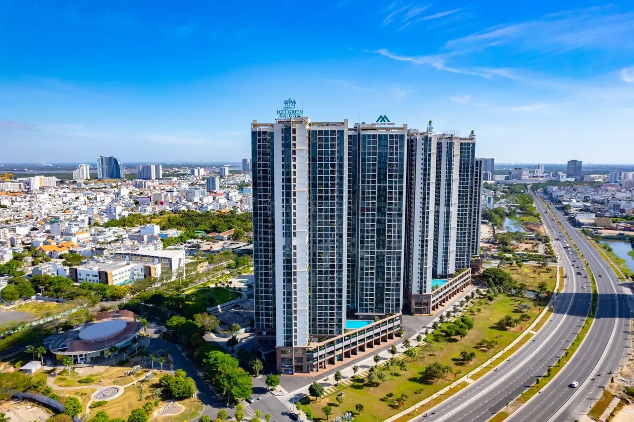
Eco Green Sai Gon Project Information
39B Nguyen Van Linh Street, Tan Thuan Ward, Ho Chi Minh City (formerly District 7) · Map ↗
A 14.36-ha apartment complex by Xuan Mai Sai Gon Construction Investment JSC, fronting Nguyen Van Linh Street, with a 3.5-ha internal park.
General information
- Developer
- Xuan Mai Sai Gon Construction Investment JSC
- Project name
- Eco Green Sai Gon
- Address
- 39B Nguyen Van Linh, Tan Thuan Ward (formerly District 7), Ho Chi Minh City
- Scale
- 14.36 ha
- Apartment towers
- 4 towers, 8 blocks: HR1 (A, B), HR2 (C, D), M2 (E, G), HR3 (H, I); 28 to 36 floors
- Number of apartments
- About 4,000 units
- Property types
- Apartments, shophouses, officetels
- Construction start
- Q1/2018
- Handover
- 2020 to 2022
- Ownership
- Long-term for Vietnamese citizens; 50 years for foreigners under current law
Overview and Architecture
Eco Green Sai Gon is planned as a self-contained complex with a central park and a range of amenities for residents. It was designed by Plus Architecture (Australia) together with Green Design, with construction starting in Q1/2018.
The project combines homes, a commercial area and shared living spaces, suiting both buyers who plan to live there and those who plan to rent out.
- Each tower has three wings that fan out like propeller blades, so many units get natural breeze and daylight.
- The 3.5-ha Eco Green Park within the grounds, with a walk over to Huong Tram Park.
- Apartments have large glass windows, balconies, wooden floors and imported sanitary fittings.
Location and Nearby Amenities
The project fronts Nguyen Van Linh Boulevard, the main artery of southern Ho Chi Minh City, at the junction between central District 1, Thu Thiem and Phu My Hung.
Reach central District 1 via Nguyen Tat Thanh Street (37 to 42 m wide) or Nguyen Thi Thap Street (35 m wide). Reach Thu Thiem via Phu My Bridge, and later also via Thu Thiem 4 Bridge.
Distances from the project
- FV Hospital2.6 km
- Crescent Mall2.8 km
- Tan My Market3 km
- Tam Duc Hospital3 km
- Ben Thanh Market3.4 km
- Lotte Mart4.4 km
- SC VivoCity4.4 km
- Ton Duc Thang Univ.5 km
- RMIT Univ.5 km
- Tan Son Nhat Airport12 km